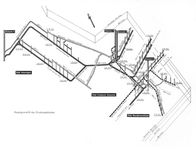
The underground map of Friedrich Heinrich colliery !
This is how it looked underground at Friedrich Heinrich colliery in the 1950s -
the deepest level was at -600 metres. In the picture above you can see all of
the roadways and shafts that existed at that time.